Thanks for that link Paul. Australia has seen a good amount of electrical activity I'd say, and it's cause likely from Solar EM storms. I found one paper on the subject:
Large-scale Electrical Conductivity Structure of Australia
http://rses.anu.edu.au/~ted/EG997150.pdf
Have only had a quick look so far. Did a little more exploring in my own area though and confirmed the existence of mainly dips in a short stretch of river that I had not explored before. I had a very briefreply from Geomagnetism Canada:
The rock of the Sooke Potholes is basalt from the Metchosin Igeous Complex, and these rocks, especially if hit by lightning, are very strongly magnetized.
So there seem to be many anomalies along the Sooke River banks, the dips being the strongest and most numerous, so I must assume a lot of lightning strikes. I'll try along the foreshore and up in the hills where electrical activity appears to have been present, but I'm pretty certain the anomalies will be numerous.
When the lightning occurred would be my next question. The geological history model for the area is that the glaciers began retreating 16 to 12 thousand years ago, so it would have to be after the retreat that the lightning struck, though I really have great doubts about the existence of the supposed deep ice sheets at all. The visible evidence would seem to show that the shattered outcrops in the hills still have all the material from the outcrop in the close vicinity, similarly with the river and creeks, nothing has been swept away by glaciers or a global deluge or tidal wave. Everything seems to be just as it was after the electrical storm, and much of it seems like it may have happened only yesterday, the evidence is so fresh looking.
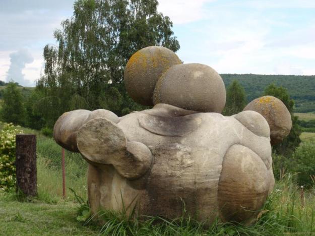
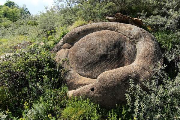
In the river and creek beds there are obvious examples of rock, both still attached to the bedrock, and in the form of rounded boulders, that are clearly not basalt any more, metamorphosis has occurred. The appearance of some of the rounded boulders in the creek beds match exactly the properties of the rock still attached to parts of the creek bed, proof enough I'd say that the rounded boulder was created from the creek bed material itself.
Difficult as it may be to accept, the evidence I see can only be explained by having the river and creeks being the result of a surface discharge, from ocean foreshore to hill and mountain tops. The lakes at the top end, most of them described as glacial cirques, are excavations where the discharge connected to what was likely a highly ionised plasma cloud, above a boundary layer. That would also likely explain the many flat topped hills, the boundary layers are very well defined.
I wish I could find a small group of well-round engineers to climb up just one creek at the Potholes this summer, as it is my belief the evidence clearly shows that glaciers or erosion or weathering could absolutely not have produced the noted features. Only one force could have done it. I realise that even if such a group agreed with my beliefs, mainstream would take no notice whatsoever. The fact I have received zero replies from E-mails and photos I have sent the Earth Sciences university departments regarding some of the features strongly suggests that they can not explain them by any conventional means, and really would rather not even talk about the matter.
So who do I complain to?

In order to change an existing paradigm you do not struggle to try and change the problematic model. You create a new model and make the old one obsolete. -Buckminster Fuller


