
Indeed, hail gets a sloppy treatment in the mainstream literature. The terminal velocity of a golfball-size hailstone (r = 22 mm) is 15 m/s. This would be slow enough to keep it suspended in a thunderstorm updraft, which can exceed 50 m/s. But not much hail is found in or around the updraft. Rather, the updraft shows up on radar as the "bounded weak echo region" (BWER). Since hail is the best radar reflector in the storm, that pretty much proves that there ain't much hail there. Hail actually falls in the forward flank downdraft, and between there and the updraft. In these areas, the air is moving down, or sideways, and that kind of air isn't going to keep a hailstone suspended by terminal velocity.Ion01 wrote:I have often wondered about the extreme size that hail can get too in storms. We are told that it is vertical winds in storms that keep these large chunks of ice aloft in the clouds. I am not sure I am convinced it is purely vertical winds...
In addition to being the storm's best radar reflector, hail is also its best negative charge carrier, since the electron cloud is so much bigger in a large particle. Since the region in which it forms straddles the freezing line (4~5 km above the surface), we just have to ask what kind of electric field is in that region. And sure enough, thunderstorms have a positively charged anvil at the top, and a main negative charge region in the middle of the cloud. The electric field exerts a force more powerful than gravity on charged particles (see MacGorman, D. R., and Rust, W. D., 1998: The Electrical Nature of Storms. Oxford University Press, pg. 57). So the electric force keeps the hailstone suspended. The toroidal recirculation of air in that part of the storm gets the hailstone traveling in a circular motion. If this circle straddles the freezing line, it will get frozen & thawed 10 or more times, forming distinct layers about 2 mm apiece, before finally falling out of the storm as a golfball from the sky.
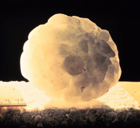
The spikey hailstones didn't start out looking so spikey -- this is mainly the effect of selective melting. Such hailstones are one-time aggregates of smaller hailstones that might have formed under varying conditions. Ones that are solid ice melt slower, while ones with looser layers of snow melt faster. Here are two examples. The latter lost about 1/3 of its size when it collided with a gutter, but is still the largest hailstone on record last time I checked. Both are clearly aggregates of smaller hailstones.
http://charles-chandler.org/Geophysics/ ... il%202.jpg
http://charles-chandler.org/Geophysics/ ... stone).jpg
See Observations on the Electromagnetic Nature of Tornadic Supercell Thunderstorms: Section 10. Hail & Wind Shear, and/or some of the other related sections, for more info.
Cheers!


